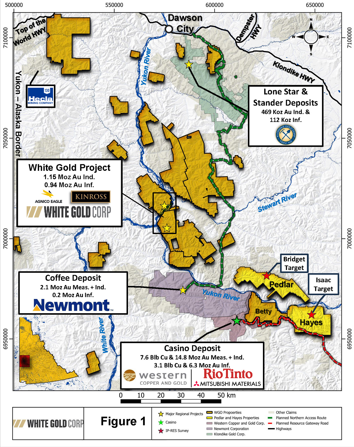
Location & Access
The Bridget target is located in the northern part of the Pedlar property approximately 135 km south-southeast of Dawson City and 305 km northwest of Whitehorse in west-central Yukon. Bridget is accessible via helicopter; small fixed-wing aircraft can land at the Scroggie Airstrip located approximately 10 km to the north.
Size
1,249 claims covering approximately 24,590 hectares
Work to Date
Stream sediment sampling, soil sampling, geological mapping and prospecting, airborne DIGHEM electromagnetics and magnetics, induced polarization, RAB drilling
Target (Mineralization)
Porphyry copper-molybdenum-gold deposits, Epithermal gold-silver deposits
Overview
The Bridget target area was first explored by Silver Standard Mines Ltd. (“Silver Standard”) and Asarco Exploration Company of Canada Ltd. (“Asarco”) in the early 1970’s following the discovery of the Casino Copper-Gold-Molybdenum porphyry deposit. A series of regional silt samples, soil sampling, and geophysical surveys by Silver Standard in 1971 and 1972 led to the discovery of a significant molybdenum-copper geochemical anomaly, now known as the Bridget target. Historical exploration work between 2004 and 2016 included soil sampling, prospecting, geological mapping, and geophysical surveys. In 2016 the Company acquired ownership of the property and has continued to expand the large multi-element (molybdenum, copper, bismuth, tungsten, lead, silver) soil geochemical anomaly that currently measures 3 km NW-SE by 4.3 km NE-SW.
The Bridget soil anomaly is interpreted to represent a copper-molybdenum porphyry target. It is geochemically zoned with a molybdenum-copper-bismuth core and a silver-zinc-lead-tungsten halo. Geological and structural mapping at the Bridget target in 2018 by consulting structural geologist Dr. Michael Cooley indicates that the bedrock geology is characterized by WNW-ESE trending units. Hornblende gneiss dominates in the northern part of the area, with a narrow (300 m) zone of felsic gneiss at the center, and metasedimentary schist and gneiss in the southern half of the area that includes a distinctive megacrystic kyanite-andalusite bearing unit and marble units that are largely altered to calc-silicate skarn. At least two distinct generations of felsic dykes and sills that strike northwest-southeast to east-west were recognized: 1) quartz eye granite dykes/sills; and 2) aplite dykes/sills. Field evidence for a porphyry mineralization model includes shreddy biotite, local occurrences of magnetite alteration, and potassic alteration where molybdenite was observed in quartz veinlets in float.
In 2023, a geophysical survey consisting of a 3.0 km long deep IP test line (line 1N) oriented NE-SW was carried out over the target using a dipole-dipole configuration. Five chargeability anomalies were identified on Line 1N, including one 1st priority anomaly (S1) and four 2nd priority anomalies (M1-M4). Anomaly S1 has a target depth of 130 m and is characterized by strong chargeability and low resistivity. Target depths on the second priority anomalies range from 40 m (M3, M4) to a maximum of 330 m (M1). These are characterized by moderate to high chargeability and low to high resistivity.
The Bridget chargeability anomalies correspond with a zone of low resistivity which underlie a large molybdenum-copper soil anomaly. A zone of moderate (M1) to strong (S1) chargeability in the southwest delineates a controlling west-northwest (WNW, 290°) striking fault structure, closely correlated with lead, zinc, and arsenic soil anomalies. To the northeast, a similar WNW (295°) anomaly in lead, zinc, and arsenic defines the boundary of this chargeability anomaly and coincides with a significant tungsten anomaly, positioned along the northeastern fringe of a molybdenum anomaly. In 2018 the Company drilled 10 short rotary air blast (RAB) drill holes totalling 548.6 m over the area between chargeability anomalies M2 and S1. However, these RAB holes were testing surface soil anomalies and drilled to a maximum depth of only 70 m, hence the newly identified IP chargeability anomalies are completely untested.


